Saturday, July 24, 2010

Goa


Goa is India's smallest state by area and the fourth smallest by population. Located on India's west coast in the region known as the Konkan, it is bounded by the state of Maharashtra to the north, and by Karnataka to the east and south, while the Arabian Sea forms its western coast. Goa is India's richest state with a GDP per capita two and a half times that of the country as a whole. It was ranked the best placed state by the Eleventh Finance Commission for its infrastructure and ranked on top for the best quality of life in India by the National Commission on Population based on the 12 Indicators.

Panaji is the state's capital, while Vasco da Gama is the largest city. The historic city of Margao still exhibits the cultural influence of thePortuguese, who first landed in the early 16th century as merchants, and conquered it soon thereafter. The Portuguese overseas territory existed for about 450 years, until it was annexed by India in 1961.
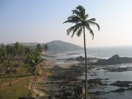
Renowned for its beaches, places of worship and world heritage architecture, Goa is visited by large numbers of international and domestic tourists each year. It also has rich flora and fauna, owing to its location on the Western Ghats range, which is classified as abiodiversity hotspot.

HISTORY

Goa's known history stretches back to the 3rd century BC, when it formed part of the Mauryan Empire, ruled by the Buddhist emperor, Ashokaof Magadha. Buddhist monks laid the foundation of Buddhism in Goa. Between the 2nd century BCE and the 6th century CE, Goa was ruled by the Chutus of Karwar as feudatories of the Satavahanas of Kolhapur (2nd century BCE to the 2nd century CE), Western Kshatrapas (around 150 CE), the Abhiras of Western Maharashtra, Bhojas of the Yadava clans of Gujarat, and 
the Konkan Mauryas as feudatories of theKalachuris.The rule later passed on to the Chalukyas of Badami, who controlled it between 578 to 753, and later the Rashtrakutas ofMalkhed from 753 to 963. However from 765 to 1015, the Southern Silharas of Konkan ruled Goa as the feudatories of the Chalukyas and the Rashtrakutas. Over the next few centuries, Goa was successively ruled by the Kadambas as the feudatories of the Chalukyas of Kalyani. They patronised Jainism in Goa.
In 1312, Goa came under the governance of the Delhi Sultanate. However, the kingdom's grip on the region was weak, and by 1370 they were forced to surrender it to Harihara I of the Vijayanagara empire. The Vijayanagara monarchs held on to the territory until 1469, when it was appropriated by the Bahmani sultans of Gulbarga. 
After that dynasty crumbled, the area fell to the hands of the Adil Shahis of Bijapur who established as their auxiliary capital the city known under the Portuguese as Velha Goa.
In 1510, the Portuguese defeated the ruling Bijapur kings with the help of a local ally, Timayya, leading to the establishment of a permanent settlement in Velha Goa .The Portuguese converted a large portion of their subjects in Goa to Christianity. The repeated wars of the Portuguese with the Marathas and the Deccan sultanate, along with the repressive religious policies of Portuguese led to large migrations of Goans to neighbouring areas. Goa was occupied by the British between 1812 and 1815 during the Napoleonic Wars.
In 1843 the capital was moved to Panjim from Velha Goa. By the mid-18th century the area under occupation had expanded to most of Goa's present day state limits. Simultaneously the Portuguese lost other possessions in India until their borders stabilised and formed the Estado da India Portuguesa, of which Goa was the largest territory.
After India gained independence from the British in 1947, Portugal refused to negotiate with India on the transfer of sovereignty of their Indian enclaves. On 12 December 1961, the Indian Army commenced with Operation Vijay resulting in the annexation of Goa, Damman and Diu into the Indian union. Goa, along 
withDaman and Diu was made into a centrally administered Union Territory of India. On 30 May 1987, the Union Territory was split, and Goa was made India's twenty-fifth state, with Daman and Diu remaining Union Territories.

GEOGRAPHY AND CLIMATE

Goa encompasses an area of 3,702 km² . It lies between the latitudes 14°53′54″ N and 15°40′00″ N and longitudes 73°40′33″ E and 74°20′13″ E. Most of Goa is a part of the coastal country known as the Konkan, which is an escarpment rising up to the Western Ghatsrange of mountains, which separate it from the Deccan Plateau. The highest point is the Sonsogor, with an altitude of 1,167 meters . Goa has a coastline of 101 km .
Goa's main rivers are the Mandovi, the Zuari, the Terekhol, Chapora River and the Sal. The Mormugao harbour on the mouth of the River Zuari is one of the best natural harbours in South Asia. The Zuari and the Mandovi are the lifelines of Goa, with their tributaries draining 69% of its geographic area. These rivers are one of the busiest rivers in India. Goa has more than forty estuarine, eight marine and about ninety riverine islands. The total navigable length of Goa's rivers is 253 km . Goa has more than three hundred ancient tanks built during the rule of the Kadamba dynasty and over a hundred medicinal springs.
Most of Goa's soil cover is made up of laterites which are rich in ferric aluminium oxides and reddish in colour. Further inland and along the riverbanks, the soil is mostly alluvial and loamy. The soil is rich in minerals and humus, thus conducive to plantation. Some of the oldest rocks in the Indian subcontinent are found in Goa between Molem and Anmod on Goa's border with Karnataka. The rocks are classified as Trondjemeitic Gneiss estimated to be 3,600 million years old, dated by the Rubidium isotope dating method. A specimen of the rock is exhibited in the Goa University.
Goa, being in the tropical zone and near the Arabian Sea, has a hot and humid climate for most of the year. The month of May is the hottest, seeing day temperatures of over 35 °C  coupled with high humidity. The monsoon rains arrive by early June and provide a much needed respite from the heat. Most of Goa's annual rainfall is received through the monsoons which last till late September.
Goa has a short winter season between mid-December and February. These months are marked by nights of around 20 °C   and days of around 29 °C with moderate amounts of humidity. Further inland, due to altitudinal gradation, the nights are a few degrees cooler. During March 2008 Goa was lashed with heavy rain and strong winds. This was the first time in 29 years that Goa had seen rain during March.

ECONOMY

Goa's gross state domestic product for 2007 is estimated at $3 billion in current prices. Goa is one of India's richest states with the highest GDP per capita and two and a half times that of the country as a whole, and one of its fastest growth rates: 8.23% (yearly average 1990–2000).Tourism is Goa's primary industry: it handles 12%[15] of all foreign tourist arrivals in India. Goa has two main tourist seasons: winter and summer. In the winter time, tourists from abroad (mainly Europe) come to Goa to enjoy the splendid climate. In the summer time (which, in Goa, is the rainy season), tourists from across India come to spend the holidays.
The land away from the coast is rich in minerals and ores and mining forms the second largest industry. Mining in Goa focuses on ores ofiron, Bauxite, manganese, clays, limestone and silica. The Marmagao Port handled 31.69 million tonnes of cargo last year, and accounts for over 39% of India's Iron Ore exports. The leaders in the Goan Iron Ore industry include Sesa Goa (now owned by Vedanta Resources) and Dempo. Rampant mining in areas rich in Iron Ore and other minerals is now threatening the forest cover as well as posing a health hazard to the local population. Mining corporations are also indulging in illegal mining in some areas without proper permits.
Agriculture, while of shrinking importance to the economy over the past four decades, offers part-time employment to a sizable portion of the populace. Rice is the main agricultural crop, followed by areca, cashew and coconut. The fishing industry provides employment for about forty thousand people, though recent official figures indicate a decline of the importance of this sector and also a fall in catch, perhaps coupled with the fact that traditional fishing has given way to large-scale mechanised trawling.
Medium scale industries include the manufacturing of pesticides, fertilisers, tyres, tubes, footwear, chemicals, pharmaceuticals, wheatproducts, steel rolling, fruits and fish canning, cashew nuts, textiles, brewery products.
The Goa government has recently decided to not allow any more special economic zones (SEZs) in Goa. This is in stark contrast to policy followed by other states of India. SEZs are known to bring tax revenues for the government and employment option for local citizens since industries flock there for lower tax rates as compared to other areas. Currently there are 16 planned SEZs in Goa. This decision was taken by state government after strong opposition to SEZs by political parties and Goa Catholic Church.
Goa is also notable for its low beer, wine and spirits prices due to its very low excise duty on alcohol. Another source of cash inflow into the state comes from many of its citizens who work abroad and remit money to their families.

TRANSPORT

Goa's sole airport, the Dabolim Airport, is both a military and civilian airport catering to domestic and international airlines that stop en route to other Indian destinations. The airport also handles a large number of chartered flights. Goa receives international flights 
from Dubai,Sharjah and Kuwait in the Middle East and from Britain, Germany and Russia during the charter flight tourist season. Dabolim Airport is serviced by the following carriers – Air India,Indian Airlines, Kingfisher Airlines, Go Air, SpiceJet, Jet Airways besides Charter flights from the UK, Russia, Germany operated by Thomas Cook, Condor, Monarch Airlines etc.
Goa's public transport largely consists of privately operated buses linking the major towns to rural areas. Government-run buses, maintained by the Kadamba Transport Corporation, links both major routes (like the Panjim–Margao route) and some remote parts of the state. In large towns such as Panjim and Margao, intra-city buses ply. However, public transport in Goa is less developed, and residents depend heavily on their own transport, usually motorised two-wheelers. Goa has two National Highways passing through it. NH-17 runs along India's west coast and links Goa to Mumbai in the north and Mangalore to the south. NH-4A running across the state connects the capital Panjim to Belgaum in east, linking Goa to cities in the Deccan. The NH-17A connects NH-17 to Mormugao Harbour from Cortalim, and the new NH-17B, is a four lane highway 
connecting Mormugao Harbour to NH-17 at another location, Verna, via Dabolim airport. Goa has a total of 224 km  of National highway, 232 km of state highway and 815 km of district highway.
Hired forms of transport include unmetered taxis, and, in urban areas, auto rickshaws. A unique form of transport in Goa is the Motorcycle taxi, operated by drivers who are locally called "pilots". These vehicles transport a single pillion rider, at fares that are usually negotiated. River crossings in Goa are serviced by flat-bottomed ferry boats, operated by the river navigation departments. Goa has two rail lines..........one run by the South Western Railway and the other by the Konkan Railway. The line run by the South Western Railway was built during the colonial era linking the port town of Vasco da Gama, Goa with Hubli, Karnataka via Margao. 
The Konkan Railway line, which was built during the 1990s, runs parallel to the coast connecting major cities on the western coast.
The Mormugao harbour near the city of Vasco handles mineral ore, petroleum, coal and international containers. Much of the shipments consist of minerals and ores from Goa's hinterland. Panjim, which is situated on the banks of the Mandovi, also has a minor port, which used to handle passenger steamers between Goa and Mumbai till the late 1980s. There was also a short-lived catamaran service linking Mumbai and Panaji operated by Damania Shipping in the 1990S.
LANGUAGES

The Goa, Daman and Diu Official Language Act, 1987 makes Konkani in the Devanagari script the sole official language of Goa, but provides that Marathi may also be used "for all or any of the official purposes". The Government also has a policy of replying in Marathi to correspondence received in Marathi. Whilst there have been demands for according Marathi and Konkani in Roman script co-equal status in the state, As of October 2008, Konkani remained the sole official language.
Konkani is spoken as a native language by about 61.21% ~~~of the people in the state. Other linguistic minorities in the state as of 1991 are Marathi <27.12%>, Kannada <3.41%>, Urdu<2.81%>, and Hindi <2.09%>. The Portuguese language, which was used during the colonial era is less popular now.

TOURISM

Tourism is generally focused on the coastal areas of Goa, with decreased tourist activity inland.
Goa has two main tourist seasons: winter and summer. In the winter time, tourists from abroad (mainly Europe) come to Goa to enjoy the splendid climate. In the summertime (which, in Goa, is the rainy season), tourists from across India come to spend the holidays.
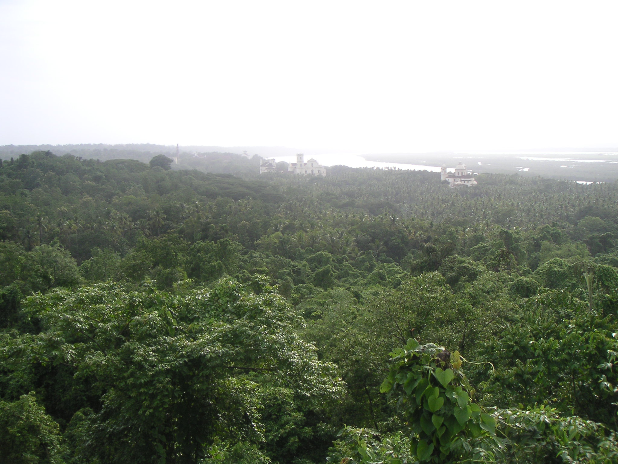
With the rule of the Portuguese for over 450 years and the consequential influence of Portuguese culture, Goa presents a somewhat different picture to the foreign visitor than other parts of the country. The state of Goa is famous for its excellent beaches, churches, and temples. The Bom Jesus Cathedral, Fort Aguada and a new a wax museum on Indian history, culture and heritage in Old Goa are other tourism destinations.

Sunday, July 4, 2010

Karnataka


Kannada is a state in the southern part of India. It was created on 1 November 1956, with the passing of the States Reorganisation Act. Originally known as the State of Mysore, it was renamed Karnataka in 1973.

Karnataka is bordered by the Arabian Sea to the west, Goa to the northwest, Maharashtra to the north, Andhra Pradesh to the east, Tamil Nadu to the southeast, and Kerala to the southwest. The state covers an area of 74,122 sq mi (191,976 km²), or 5.83% of the total geographical area of India. It is the eighth largest Indian state by area, the ninth largest by population and comprises 30 districts. Kannadais the official and most widely spoken language.

Though several etymologies have been suggested for the name Karnataka, the generally accepted one is that Karnataka is derived from the Kannada words karu and nādu, meaning elevated land. Karu nadu may also be read as Karu (black) and nadu (region), as a reference to the black cotton soil found in the Bayaluseeme region of Karnataka. The British used the word Carnatic (sometimes Karnatak) to describe both sides of peninsular India, south of the Krishna River.
With an antiquity that dates to the paleolithic, Karnataka has also been home to some of the most powerful empires of ancient and medieval India. The philosophers and musical bards patronised by these empires launched socio-religious and literary movements which have endured to the present day. Karnataka has contributed significantly to both forms of Indian classical music, the Carnatic (Karnataka Music) and Hindustani traditions. Writers in the Kannada language have received the most number of Jnanpith awards in India. Bangaloreis the capital city of the state and is at the forefront of the rapid economic and technological development that India is experiencing.

history of Karnataka

The history of Karnataka can be traced back to a paleolithic hand-axe culture evidenced by discoveries of, among other things, hand axes and cleavers in the region[citation needed]. Evidence of neolithic andmegalithic cultures have also been found in the state. Gold discovered in Harappa was found to be imported from mines in Karnataka, prompting scholars to hypothesize about contacts between ancient Karnataka and the Indus Valley Civilization in 3000 BCE. Prior to the third century BCE, most of Karnataka was part of the Nanda Empire before coming under the Mauryan empire of Emperor Ashoka. Four centuries of Satavahana rule followed, allowing them to control large areas of Karnataka. The decline of Satavahana power led to the rise of the earliest native kingdoms, the Kadambas and the Western Gangas, marking the region's emergence as an independent political entity. The Kadamba Dynasty, founded by Mayurasharma, had its capital at Banavasi;the Western Ganga Dynasty was formed with Talakad as its capital.
Hoysala Empire sculptural articulation in Belur.
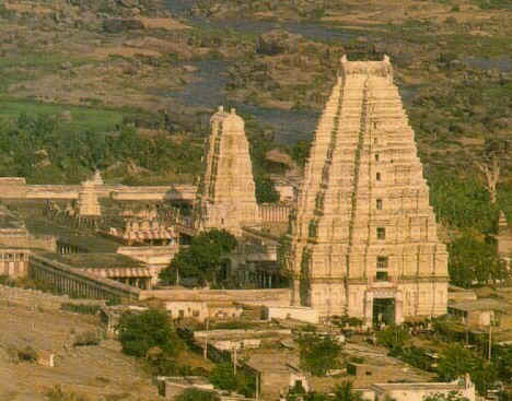
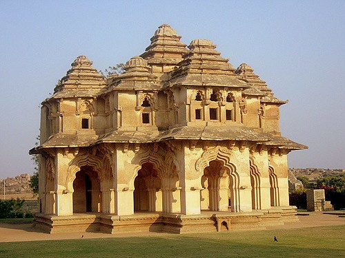
Statue of Ugranarasimha atHampi (a World Heritage Site), located within the ruins ofVijayanagara, the former capital of the Vijayanagara Empire.
These were also the first kingdoms to use Kannada in administration, as evidenced by the Halmidi inscription and a fifth-century copper coin discovered at Banavasi.These dynasties were followed by imperial Kannada empires such as the Badami Chalukyas, the Rashtrakuta Empire of Manyakheta and the Western Chalukya Empire which ruled over large parts of the Deccan and had their capitals in what is now Karnataka. The Western Chalukyas patronised a unique style of architecture and Kannada literature which became a precursor to the Hoysala art of 12th century.
Parts of modern-day Karnataka were occupied by the Chola Empire between 990-1210 AD. This process started under Rajaraja Chola I (985-1014) and continued under his son Rajendra Chola I (1014–1044). Initially "Gangapadi, Nolambapadi and Tadigaipadi' all parts of modern Mysore, were conquered and annexed' under Raja Raja Chola I. Rajendra Chola I "marched up to Donur, he also captured Banvasi, a good part of the Raichur doab and sacked Manyakheta" itself, which was the Western Chalukyan capital. During the time of the Chalukya rulerJayasimha after his defeat by Rajendra Chola I, the Tungabhadra river was recognized tacitly as the boundary between the two kingdoms. During the rule of Rajadhiraja Chola I (1042–1056), Dannada, Kulpak, Koppam, the fortress of Kampili, Pundur, Yetagiri and the Chalukyan capital Kalyani were sacked. In 1053, Rajendra Chola IIafter defeating the Chalukyans in war advanced to Kollapura where he erected a pillar of victory before returning to his capital at Gangaikondacholapuram. In 1066, the Western Chalukya ruler Somesvara's forces were defeated by the next Chola ruler Virarajendra, who then again defeated the Western Chalukyas at Kudalasangama, and set up a pillar of victory on the banks of the Tungabhadra. In AD 1075Kulottunga Chola I won a victory against Vikramaditya VI at Nangili in Kolar district and made himself the master of Gangavadi. The Cholas eventually lost Gangavadi in 1116 to the Hoysalas under Vishnuvardhana.


At the turn of the first millennium, the Hoysalas gained power in the region. Literature flourished during this time, which led to the distinctive Kannadaliterary metres and the construction of temples and sculptures adhering to the Vesara style of architecture. The expansion of the Hoysala Empire brought parts of modern Andhra Pradesh and Tamil Nadu under its rule. In the early 14th century, Harihara and Bukka Raya established the Vijayanagara empire with its capital,Hosapattana (later named Vijayanagara), on the banks of the Tungabhadra River in the modern Bellary district. The empire rose as a bulwark against Muslim advances into South India, which it completely controlled for over two centuries.

In 1565, Karnataka and the rest of South India experienced a major geopolitical shift when the Vijayanagara Empire fell to a confederation of Islamic sultanates in the Battle of Talikota. The Bijapur Sultanate, which had risen after the demise of the Bahmani Sultanate of Bidar, soon took control of the Deccan; it was defeated by the Moghuls in the late 17th century. The Bahamani and Bijapur rulers encouraged Urdu and Persian literature and Indo-Saracenic architecture, the Gol Gumbaz being one of the high points of this style.During the sixteenth century, Konkani Hindus migrated to Karnataka, mostly from Salcette, Goa, while during the seventeenth and eighteenth century, the Mangalorean Catholicsmigrated to South Canara, in Karnataka, especially from Bardes, Goa, as a result of food shortages, epidemics and heavy taxation imposed by the Portuguese.

An inveterate enemy of the British, Tipu Sultan of Mysore Kingdom was one of the most powerful rulers in India before the advent of the British Raj.

In the period that followed, parts of northern Karnataka were ruled by the Nizam of Hyderabad, the British, and other powers. In the south, the Mysore Kingdom, former vassals of the Vijayanagara Empire, was briefly independent. With the death of Krishnaraja Wodeyar II, Haidar Ali, the commander-in-chief of the Mysore army, gained control of the region. After his death, the kingdom was inherited by his son Tippu Sultan. To contain European expansion in South India, Haidar Ali and later Tippu Sultan fought four significant Anglo-Mysore Wars, the last of which resulted in Tippu Sultan's death and the incorporation of Mysore into the British Raj in 1799. The Kingdom of Mysore was restored to the Wodeyars and Mysore remained a princely state under the British Raj.

As the "doctrine of lapse" gave way to dissent and resistance from princely states across the country, Kittur Chennamma, Sangolli Rayanna and others spearheaded rebellions in Karnataka in 1830, nearly three decades before the Indian Rebellion of 1857. Other uprisings followed, such as the ones at Supa, Bagalkot, Shorapur, 
Nargund and Dandeli. These rebellions 
which coincided with the 1857 war 
of independence were led by Mundargi Bhimarao, Bhaskar Rao Bhave, the Halagali Bedas, Venkatappa Nayaka and others. By the late 19th century, the freedom movement had gained momentum; Karnad Sadashiva Rao, Aluru Venkata Raya, S. Nijalingappa, Kengal Hanumanthaiah, Nittoor Srinivasa Rau and others carried on the struggle into the early 20th century.

After India's independence, the Maharaja, Jayachamarajendra Wodeyar, allowed his kingdom's accession to India. In 1950, Mysore became an Indian state of the same name; the former Maharaja served as its Rajpramukh (head of state) until 1975. Following the long-standing demand of theEkikarana Movement, Kodagu and Kannada speaking regions from the adjoining states of Madras, Hyderabad and Bombay were incorporated into the Mysore state, under the States Reorganization Act of 1956. The thus expanded state was renamed Karnataka, seventeen years later, in 1973. In the early 1900s through the post-independence era, industrial visionaries such as Sir Mokshagundam Visvesvarayya born in Muddenahalli, 

nearKanivenarayanapura, 
Chikballapur District played an 
important role in the development of Karnataka's strong manufacturing and industrial base.
Geography
Geography of Karnataka and Rainfall in Karnataka
Jog Falls are the highest plunge waterfalls in India, 
formed by Sharavathi River.
The state has three principal geographical zones: the coastal region of Karavali, the hilly Malenadu region comprising the Western Ghats and theBayaluseeme region comprising the plains of the Deccan plateau. The bulk of the state is in the Bayaluseeme region, the northern part of which is the second largest arid region in India. The highest point in Karnataka is the Mullayanagiri hills in Chikkamagaluru district which has an altitude of 1,929 metres (6,329 ft). 

Some of the important rivers 
in Karnataka are Kaveri,
 Tungabhadra, Krishna, 
Malaprabha and 
the Sharavathi.

Karnataka consists of four main types of geological formations the Archean complex made up of Dharwad schists and granitic gneisses, theProterozoic non-fossiliferous sedimentary formations of the Kaladgi and Bhima series, the Deccan trappean and intertrappean deposits and the tertiary and recent laterites and alluvial deposits. Significantly, about 60% of the state is composed of the Archean complex which consist of gneisses, granites and charnockite rocks. Laterite cappings that are found in many districts over the Deccan Traps were formed after the cessation of volcanic activity in the early tertiary period. Eleven groups of soil orders are found in Karnataka, 

viz. Entisols, Inceptisols, 
Mollisols,Spodosols, 
Alfisols, Ultisols, Oxisols, 
Aridisols, Vertisols, 
Andisols and Histosols. Depending on the agricultural capability of the soil, the soil types are divided into six types, viz. Red, lateritic, black, alluvio-colluvial, forest and coastal soils.

Karnataka experiences four seasons. The winter in January and February is followed by summer between March and May, the monsoon season between June and September and the post-monsoon season from October till December. Meteorologically, Karnataka is divided into three zones  coastal, north interior and south interior. Of these, the coastal zone receives the heaviest rainfall with an average rainfall of about 3,638.5 mm (143 in) per annum, far in excess of the state average of 1,139 mm (45 in). Agumbe in the Shivamogga district receives the second highest annual rainfall in India. The highest recorded temperature was 45.6 °C (114 °F) at Raichur and the lowest recorded temperature was 2.8 °C (37 °F) at Bidar.

About 38,724 km2 (14,951 sq mi) of Karnataka (i.e. 20% of the state's geographic area) is covered by forests. The forests are classified as reserved, protected, unclosed, village and private forests. The percentage of forested area is slightly less than the all-India average of about 23%, and significantly less than the 33% prescribed in the National Forest Policy.

Government and administration

Karnataka, like other Indian states, has a parliamentary system of government with two democratically elected houses, the Legislative Assembly and the Legislative Council. The Legislative Assembly consists of 224 members who are elected for five-year terms. The Legislative Council is a permanent body of 75 members with one-third (25 members) retiring every two years.

The government of Karnataka is headed by the Chief Minister who is chosen by the ruling party members of the Legislative Assembly. The Chief Minister, along with the council of ministers, drives the legislative agenda and exercises most of the executive powers. However, the constitutional and formal head of the state is the Governor who is appointed for a five-year term by the President of India on the advice of the Union government. The people of Karnataka also elect 28 members to the Lok Sabha, the lower house of the Indian Parliament. The members of the state Legislative Assembly elect 12 members to the Rajya Sabha, the upper house of the Indian Parliament.


For administrative purposes, Karnataka has been divided into four revenue divisions, 49 sub-divisions, 29 districts, 175 taluks and 745 hoblies/revenue circles. The administration in each district is headed by a Deputy Commissioner who belongs to the Indian Administrative Service and is assisted by a number of officers belonging to Karnataka state services. The Deputy Commissioner of Police, an officer belonging to the Indian Police Service and assisted by the officers of the Karnataka Police Service, is entrusted with the responsibility of maintaining law and order and related issues in each district. The Deputy Conservator of Forests, an officer belonging to the Indian Forest Service, also serves the government. Sectoral development in the districts is looked after by the district head of each development department such as Public Works Department, Health, Education, Agriculture, Animal Husbandry, etc. The judiciary in the state consists of the Karnataka High Court (Attara Kacheri) in Bangalore,district and session courts in each district and lower courts and judges at the taluk level.


Politics in Karnataka has been dominated by three political parties, the Indian National Congress, the Janata Dal (Secular) and the Bharatiya Janata Party. Politicians from Karnataka have played prominent roles in federal government of India with some of them having held the high positions of Prime Minister and Vice President. Three cabinet levels ministers in the current United Progressive Alliance government are from Karnataka. Notable among these is Former Chief Minister and Honorable Union Minister for Law, Justice and Company Affairs,Veerappa Moily. Border disputes involving Karnataka's claim on the Kasaragod and Sholapur[60] districts and Maharashtra's claim on Belgaum are ongoing since the states reorganisation. The official emblem of Karnataka has a Ganda Berunda in the centre. Surmounting this are four lions facing the four directions, taken from the Lion Capital of Asoka atSarnath. The emblem also carries two Sharabhas with the head of an elephant and the body of a lion.

Economy

Karnataka, which had an estimated GSDP (Gross State Domestic Product) of about US$ 58.23 billion in 2008-09 fiscal year. Karnataka recorded the highest growth rates in terms of GDP and per capita GDP in the last decade compared to other states.

The state registered a GSDP growth rate of 7% for the year 2007-2008. Karnataka's contribution to India's GDP in the year 2004-05 was 5.2%. Karnataka was the fastest growing state over the past decade in terms of GDP and per capita GDP. With GDP growth of 56.2% and per capita GDP growth of 43.9%, Karnataka now has the sixth highest per-capita GDP of all states.[65] Till September 2006 Karnataka received a Foreign Direct Investment of Rs. 78.097 billion ($ 1.7255 billion) for the fiscal year 2006-07, placing it third among the states of India.[66] At the end of 2004, the unemployment rate in Karnataka was 4.94% compared to the national rate of 5.99%. For the fiscal year 2006-07, the inflation rate in Karnataka was 4.4%, compared to the national average of 4.7%. As of 2004-05, Karnataka had an estimated poverty ratio of 17%, less than the national ratio of 27.5%.

Nearly 56% of the workforce in Karnataka is engaged in agriculture and related activities. A total of 12.31 million hectares of land, or 64.6% of the state's total area, is cultivated. Much of the agricultural output is dependent on the southwest monsoon as only 26.5% of the sown area is irrigated.

Karnataka is the manufacturing hub for some of the largest public sector industries in India, including Hindustan Aeronautics Limited, National Aerospace Laboratories, Bharat Heavy Electricals Limited, Indian Telephone Industries, Bharat Earth Movers Limited and Hindustan Machine Tools, which are based in Bangalore. Many of India's premier science and technology research centers, such as Indian Space Research Organization, Central Power Research Institute, Bharat Electronics Limited and the Central Food Technological Research Institute, are also headquartered in Karnataka. Mangalore Refinery and Petrochemicals Limited is an oil refinery located in Mangalore.


Since the 1980s, Karnataka has emerged as the pan-Indian leader in the field of IT (information technology). As of 2007, there were nearly 2,000 firms operating out of Karnataka. Many of them, including two of India's biggest software firms, Infosys and Wipro are also headquartered in the state. Exports from these firms exceeded Rs. 50,000 crores ($12.5 billion) in 2006-07, accounting for nearly 38% of all IT exports from India. The Nandi Hills area in the outskirts of Devanahalli is the site of the upcoming $22 Billion, 50 square kilometer BIAL IT Investment Region, one the largest infrastructure projects in the history of Karnataka. All this has earned the state capital, Bangalore, the sobriquet Silicon Valley of India.


Transport

Air transport in Karnataka, as in the rest of the country, is still a fledgling but fast expanding sector. Karnataka has airports at Bangalore,Mangalore, Hubli, 

Belgaum, 
Hampi and Bellary 
with international operations from 
Bangalore and Mangalore airports.
 Airports at Mysore,Gulbarga, 
Bijapur, Hassan and Shimoga 
are expected to be operational 
by the end of 2007. 
Major airlines such as Kingfisher 
Airlines andAir Deccan are based in Bangalore.

Karnataka has a railway network with a total length of approximately 3,089 kilometres (1,919 mi). Until the creation of the South Western Zone headquartered at Hubli in 2003, the railway network in the state was in the Southern and Western railway zones. Several parts of the state now come under the South Western Zone, with the remainder under the Southern Railways. Coastal Karnataka is covered under the Konkan railwaynetwork which was considered India's biggest railway project of the century. Bangalore is extensively connected with inter-state destinations while other important cities and towns in the state are not so well-connected.
Karnataka has 11 ports, including the New Mangalore Port, a major port and ten other minor ports.[86] The New Mangalore port was incorporated as the ninth major port in India on 4 May 1974. This port handled 32.04 million tonnes of traffic in the fiscal year 2006-07 with 17.92 million tonnes of imports and 14.12 million tonnes of exports. The port also handled 1015 vessels including 18 cruise vessels during the year 2006-07. The inland water transport within the state is not well developed.


The total lengths of National Highways and state highways in Karnataka are 3,973 kilometres (2,469 mi) and 9,829 kilometres (6,107 mi), respectively. The KSRTC, the state public transport corporation, transports an average of 2.2 million passengers daily and employs about 25,000 people. In the late nineties, KSRTC was split into three corporations, viz., The Bangalore Metropolitan Transport Corporation, The North-West Karnataka Road Transport Corporation and The North-East Karnataka Road Transport Corporation with their headquarters in Bangalore, Hubli and Gulbarga respectively.

Language

The Kannada language is the official language of the state, the native language of approximately 65% of its population and one of the classical languages of India. Kannada played a crucial role in the creation of Karnataka since linguistic demographics was a major criterion chosen to create the state in 1956. Tulu, Kodava Takk and Konkani are other major native languages that share a long history in the state. Urdu is spoken widely by the Muslim population. Less widely spoken languages include Beary bashe and certain dialects such as Sankethi. Kannada features a rich and ancient body of literature covering topics as diverse as Jainism, Vachanas, Haridasa Sahitya and modern literature. Evidence from edicts during the time of Ashoka the Greatsuggest that the Kannada script and its literature were influenced by Buddhist literature. The Halmidi inscription, the earliest attested full-length inscription in the Kannada language and script, is dated to 450 CE while the earliest available literary work, the Kavirajamarga, has been dated to 850 CE. References made in the Kavirajamarga, however, prove that Kannada literature flourished in the Chattana, 

Beddande and 
Melvadumetres during 
earlier centuries.

Rashtrakavi Kuvempu, a doyen of 20th century Kannada literature.


Kuvempu, the renowned Kannada poet and writer who wrote Jaya Bharata Jananiya Tanujate, the state anthem of Karnataka was the first recipient of the "Karnataka Ratna" award, the highest civilian award bestowed by the Government of Karnataka. Contemporary Kannada literature is well recognized in the arena of Indian literature, with seven Kannada writers winning India's highest literary honour, the Jnanpith award, which is the highest for any language in India. Tulu is spoken mainly in the coastal districts of Udupi and Dakshina Kannada. Tulu Mahabharato, written by Arunabja in Tulu script, is the oldest surviving Tulu text. The Tulu language now uses the Kannada script due to the gradual decline of the Tulu script, which was in use until a few centuries ago. The Kodavas who mainly reside in the Kodagu district, speak Kodava Takk. Two regional variations of the language exist, the northern Mendale Takka and the southern Kiggaati Takka.Konkani is mostly spoken in the Uttara Kannada district and in some parts of the Udupi and Dakshina Kannada districts. Both Kodava Takk and Konkani use the Kannada script for writing. English is the medium of education in many schools and widely used for business communication in technology-related companies and BPOs.

All of the state's languages are patronised and promoted by governmental and quasi-governmental bodies. The Kannada Sahitya Parishat and the Kannada Sahitya Akademi are responsible for the promotion of Kannada while the Karnataka Konkani Sahitya Akademi, The Tulu Sahitya Akademi and the Kodava Sahitya Akademi promote their respective languages.

Education

Indian Institute of Science, one of the premier institutes of India located in Bangalore.
As per the 2001 census, Karnataka had a literacy rate of 67.04%, with 76.29% of males and 57.45% of females in the state being literate.The state is home to some of the premier educational and research institutions of India such as the Indian Institute of Science, the Indian Institute of Management, the National Institute of Technology Karnataka and the National Law School of India University.

As of March 2006, Karnataka had 54,529 primary schools with 252,875 teachers and 8.495 million students, and 9498 secondary schools with 92,287 teachers and 1.384 million students. There are three kinds of schools in the state, viz., government-run, private aided (financial aid is provided by the government) and private unaided (no financial aid is provided). The primary languages of instruction in most schools are Kannada and English. The syllabus taught in the schools is either of the CBSE, the ICSE or the state syllabus (SSLC) defined by the Department of Public Instruction of the Government of Karnataka. However, some schools follows NIOS syllabus. The State has one Sainik School in Bijapur also.


In order to maximize attendance in schools, the Karnataka Government has launched a mid-day meal scheme in government and aided schools in which free lunch is provided to the students. Statewide board examinations are conducted at the end of the period of secondary education and students who qualify are allowed to pursue a two-year pre-university course; after which students become eligible to pursueunder-graduate degrees.

There are 481 degree colleges affiliated with one of the universities in the state, viz. Bangalore University, Gulbarga University, Karnatak University, Kuvempu University, Mangalore University and Mysore University. In 1998, the engineering colleges in the state were brought under the newly formed Visvesvaraya Technological University headquartered atBelgaum, whereas the medical colleges are run under the jurisdiction of the Rajiv Gandhi University of Health Sciences. Some of these baccalaureate colleges are accredited with the status of a deemed university. There are 123 engineering, 35 medical and 40 dental colleges in the state. Udupi, Sringeri, Gokarna and Melkote are well-known places of Sanskrit andVedic learning. An Indian Institute of Technology Muddenahalli has been approved by the central government as part of the 11th 5 year plan. This will be the first IIT in Karnataka State. In addition, a 600 crore Visvesvaraya Institute of Advanced Technology (VIAT) is being constructed in Muddenahalli-Kanivenarayanapura.

Tourism

By virtue of its varied geography and long history, Karnataka hosts numerous spots of interest for tourists. There is an array of ancient sculptured temples, modern cities, scenic hill ranges, unexplored forests and endless beaches. Karnataka has been ranked as the fourth most popular destination for tourism among the states of India. Karnataka has the second highest number of nationally protected monuments in India, second only to Uttar Pradesh, in addition to 752 monuments protected by the State Directorate of Archaeology and Museums. Another 25,000 monuments are yet to receive protection.

Gol Gumbaz at Bijapur, has the second largest pre-modern dome in the world after the Byzantine Hagia Sophia.

The districts of the Western ghats and the southern districts of the state 

have popular eco-tourism 
locations including Kudremukh,
 Madikeri and Agumbe. 
Karnataka has 25 wildlife 
sanctuaries and five national parks. Popular among them are Bandipur National Park, Bannerghatta National Park andNagarhole National Park. The ruins of the Vijayanagara Empire at Hampi and the monuments of Pattadakalare on the list of UNESCO's World Heritage Sites. The cave temples at Badami and the rock-cut temples at Aihole representing the Badami Chalukyan style of architecture are also popular tourist destinations. The Hoysala temples at Belur andHalebidu, which were built with Chloritic schist (soap stone) are proposed UNESCO World Heritage sites. The Gol Gumbaz and Ibrahim Rauza are famous examples of the Deccan Sultanate style of architecture. The monolith of Gomateshwara at Shravanabelagola is the tallest sculpted monolith in the world, attracting tens of thousands of pilgrims during the Mahamastakabhisheka festival.

Mysore Palace at Night, Mysore, Karnataka.

The waterfalls of Karnataka and Kudremukh National Park are listed as must-see places and among the "1001 Natural Wonders of the World". Jog Falls is India's tallest single-tiered waterfall with Gokak Falls, Unchalli Falls, Magod Falls, Abbey Falls and Shivanasamudra Falls among other popular waterfalls.

Several popular beaches dot 

the coastline including 
Murudeshwara, 
Gokarna and Karwar. 
In addition, Karnataka is home 
to several places of religious 
importance. 
Several Hindu temples including the famous Udupi Krishna Temple, the Marikamba Temple at Sirsi, the Sri Manjunatha Temple at Dharmasthala, Sri Subramanya Temple at Kukke and Sharadamba Temple at Sringeri attract pilgrims from all over India. Most of the holy sites of Lingayats, like Kudalasangama and Basavana Bagewadi, are found in northern parts of the state. 
Shravanabelagola, 
Mudabidri andKarkala are 
famous for Jain history and 
monuments. The Jaina faith 
had a stronghold in Karnataka in the early medieval period withShravanabelagola as its most important center.

Recently Karnataka has emerged as a hot spot for health care tourism. Karnataka has the highest number of approved health systems and alternative therapies in India. Along with some ISO certified government-owned hospitals, private institutions which provide international-quality services have caused the health care industry to grow by 30% during 2004-05. Hospitals in Karnataka treat around 8,000 health tourists every year